


Precinct 17, Roosevelt County, Montana
About
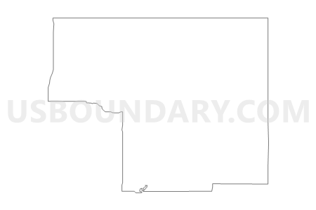
Outline

Summary
| Unique Area Identifier | 612250 |
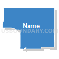
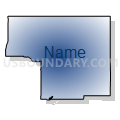
| Name | Precinct 17 |
| County | Roosevelt County |
| State | Montana |
| Area (square miles) | 643.91 |
| Land Area (square miles) | 643.43 |
| Water Area (square miles) | 0.48 |
| % of Land Area | 99.93 |
| % of Water Area | 0.07 |
| Latitude of the Internal Point | 48.39716730 |
| Longtitude of the Internal Point | -105.06484370 |
Maps


Graphs
Select a template below for downloading or customizing gragh for Precinct 17, Roosevelt County, Montana


Neighbors
Neighoring Voting District (by Name) Neighboring Voting District on the Map
- Precinct 10, Roosevelt County, MT
- Precinct 12, Roosevelt County, MT
- Precinct 15, Roosevelt County, MT
- Precinct 16, Roosevelt County, MT
- Precinct 2, Sheridan County, MT
- Precinct 2, Daniels County, MT
- Precinct 20, Roosevelt County, MT
- Precinct 28, Roosevelt County, MT
- Precinct 3, Daniels County, MT
Top 10 Neighboring County Subdivision (by Population) Neighboring County Subdivision on the Map
- Fort Peck Reservation CCD, Roosevelt County, MT (8,847)
- Fort Peck Reservation CCD, Sheridan County, MT (88)
- Fort Peck Reservation CCD, Daniels County, MT (70)
Top 10 Neighboring Elementary School District (by Population) Neighboring Elementary School District on the Map
- Poplar Elementary School District, MT (3,523)
- Culbertson Elementary School District, MT (1,022)
- Brockton Elementary School District, MT (556)
- Frontier Elementary School District, MT (430)
- Froid Elementary School District, MT (430)
Top 10 Neighboring Secondary School District (by Population) Neighboring Secondary School District on the Map
- Wolf Point High School District, MT (4,635)
- Poplar High School District, MT (3,523)
- Culbertson High School District, MT (917)
- Brockton High School District, MT (556)
- Froid High School District, MT (430)
Top 10 Neighboring Unified School District (by Population) Neighboring Unified School District on the Map
Top 10 Neighboring State Legislative District Lower Chamber (by Population) Neighboring State Legislative District Lower Chamber on the Map
Top 10 Neighboring State Legislative District Upper Chamber (by Population) Neighboring State Legislative District Upper Chamber on the Map
Top 10 Neighboring 111th Congressional District (by Population) Neighboring 111th Congressional District on the Map
Top 10 Neighboring Census Tract (by Population) Neighboring Census Tract on the Map
- Census Tract 9400.01, Roosevelt County, MT (4,549)
- Census Tract 9400.02, Roosevelt County, MT (4,298)
- Census Tract 203, Daniels County, MT (1,751)
- Census Tract 904, Sheridan County, MT (1,006)
Top 10 Neighboring 5-Digit ZIP Code Tabulation Area (by Population) Neighboring 5-Digit ZIP Code Tabulation Area on the Map
- 59201, MT (5,100)
- 59255, MT (3,429)
- 59263, MT (1,349)
- 59218, MT (927)
- 59213, MT (772)
- 59226, MT (410)
- 59247, MT (314)
- 59222, MT (221)
- 59258, MT (110)